|
Site Map |
PDX Maps |
Places People The Law Public Transport Personal Vehicles
|
Greater Portland Area
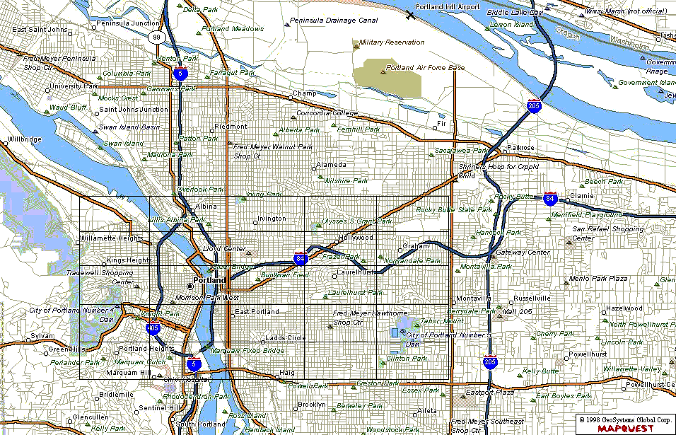
Well, I guess I have to get sick to get anything done around here. The Ratboy and I came down with a cold one weekend, and I started playing around with the image map again. Lo and Behold, the damn thing actually works! I am going to move the old table form to here for those who still like it. This is just a preliminary design, things will be changing as I add more elements and location descriptions to the sourcebook. Click on any one of the above links to view that area map and the descriptions of any locations in that area. Please note that I do not have sub-maps for the entire Greater PDX area; I have limited myself to the area surrounding the Downtown marker. This area spans from Willamete Heights in the West to Graham in the East, and from Irving Park in the North to Haig in the South. This covers roughly 28 square miles, which is alot more area than the Night City Sourcebooks covers, but I feel it is necessary for this city. Additional Resources - As much as I hate to admit it, Microsoft has actually put together a decent site with the U.S. Geographical Service: The Terraserver Project. Go there and enter the name of any American city or area, and it will bring up the most recent arial photographs of the area, so you can get a detaialed (though black-and-white) bird's-eye view down to a resolution of 1 meter. Portland's pics are circa 16 Sep 1993. |